Get to Know Wisconsin's Ice Age Trail, A Hiker's Paradise
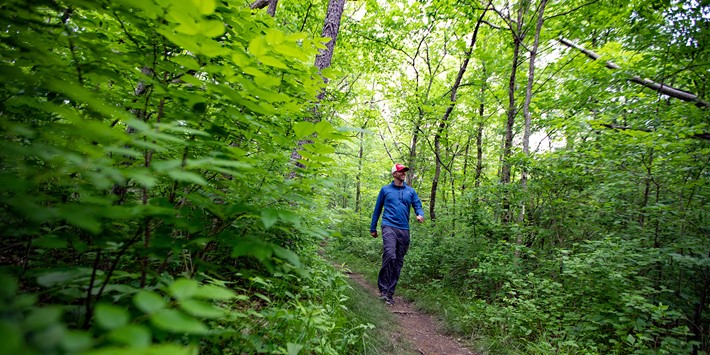
Wisconsin is full of quiet places that feel a world away from the daily grind. To soak up the state’s natural beauty at its very best, look no further than the Ice Age Trail, a 1,200-mile footpath snaking its way through Wisconsin’s forests and prairies.
What is the Ice Age Trail?
Wisconsin is brimming with historic destinations, and you’ll find few as old as the Ice Age National Scenic Trail. It’s the result of glacial ice that carved out the landscape over…wait for it…12,000 years ago! Winding through 31 counties, it was first started in the 1950s and became official in 1980. You’ll spy plenty of geological features like kettles and moraines that the glacier left behind as you traverse this stunning trail.
Where does it run?
The Ice Age Trail meanders between Sturgeon Bay and the St. Croix River, making its way between the eastern and western parts of the state. It also flanks some major cities, like Madison, Manitowoc and Janesville.
Why is it famous?
It’s one of the most easily accessible trails around, lying within 20 miles of 60% of Wisconsin residents. It’s one of the nation’s 11 scenic trails (and one of only two national scenic trails contained entirely within one state), and since much of it is considered an “off-road” hiking trail (meaning the majority is unpaved and natural), it’s similar in feel to the Appalachian Trail.
What are some popular stops along the way?
The trail gives trekkers a taste of the varied regions of our state, all with noteworthy places to stop. If you’d like to view some natural points of interest, don’t miss the prominent glacial features seen in Kettle Moraine State Forest. Timm’s Hill, located near Ogema, is the highest natural point in Wisconsin and rests along the Rib Lake Segment. The Ice Age Trail also makes its way through Baraboo’s Devil’s Lake State Park, Wisconsin’s largest state park.
Hike the trail in Two Rivers and you’ll discover the Historic Washington House, home to an old-fashioned ice cream parlor (the birthplace of the sundae, invented in 1881) and the Two Rivers Historical Museum.
On the Janesville segment, head to the Rotary Botanical Gardens, a 20-acre feast for the eyes famous for its 4,000 plant varieties.
And this is just scratching the surface—the trail is chock full of stops you and your family will love.
Are certain segments easier or more difficult?
Every skill level is welcome on the Ice Age Trail, although some segments are easier than others. For instance, the Verona Segment near Madison has a paved bike trail that’s friendly to casual walkers. Other areas of the trail are considered easy as well, like the Gandy Dancer Segment with its 15 miles of paved crushed stone or the 10.4-mile Janesville Segment smoothed over in asphalt.
While many segments lie in the “Moderate” zone, there are some that are difficult and ideal for experienced hikers. The Devil’s Lake Segment is known for its rocky, near-vertical climbs on the bluffs. Another segment that requires some gumption is the Gibraltar Segment, located near Lodi. The upward climb will be worth it for the sweeping views of the Baraboo Hills.
What is the scenery like?
You can view all types of natural areas during your Ice Age Trail hike. While much of it displays its well-known rocky terrain, other segments lie in grassy prairies strewn with wildflowers. Or along bodies of water, like Lake Michigan and the Wisconsin River. Or even within quaint downtown areas. It all depends upon the segment you choose for your hike, and that’s what makes the Ice Age Trail such a one-of-a-kind wonder.
There's more to explore! Keep on trekkin' through these highlights of the Chequamegon-Nicolet National Forest.
Ready for refreshing outdoor fun? Check trail conditions and know before you go with the Wisconsin Trail Report.
Deals


